A History of Pinxton
Pinxton is a large village, mainly in Derbyshire but partly in Nottinghamshire. It lies about three miles east of Alfreton, six miles south-southeast of Mansfield. It is in the parliamentary division of Bolsover, hundred of Scarsdale and rural district of Bolsover.
The ecclesiastical parish is part of the rural deanery of Alfreton, archdeaconry of Chesterfield and diocese of Derby.
The earliest settlement is believed to be the Saxon manor of Snodeswic – written ‘Esnotrewic’ in the Domesday Book. The name Pinxton most likely evolved from Norman times when Drogo Fitze Ponce held the manor. Over the years the name changed from Ponceston through Ponkeston, Pynkeston and Pynxton to Pinxton.
The Saxon manor no doubt had its centre near the Toll Bar crossroads. The lord’s hall may have been situated where Manor Farm stood. The few cottages would line the west side of the Green (now the bottom of Town Street).
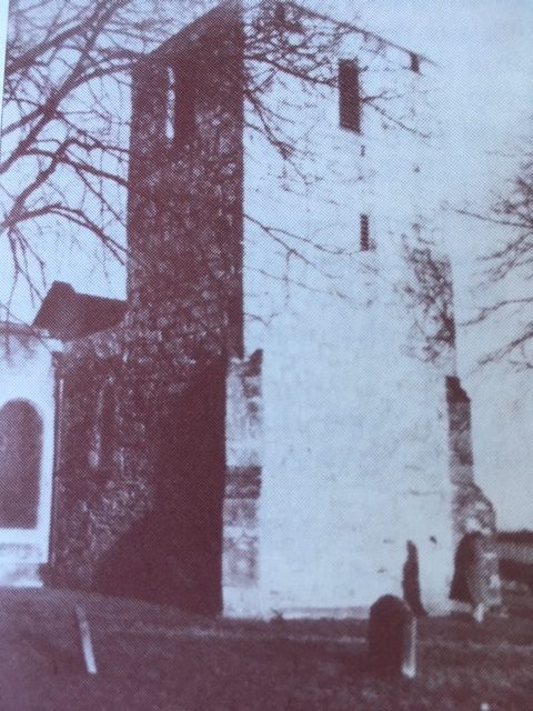
The Norman lord looked for an easily defended site, and built his castle where St Helen’s Church now stands. All that remains of his building is the chapel, which forms the south transept of the parish church. Some of the stones from the castle were used in the building of the tower. The church, although in the geographical centre of the parish, is still to the north and west of the main settlement.
During the last decade of the 13th century the first parish church was built on the site of the abandoned castle. The old private chapel was incorporated as the south transept. The first Rector, Richard de Hereford, was instituted in 1299, the patron being Dionysius le Wyne. The church was dedicated to St. John the Evangelist. After the middle of the 16th century the use of the name of the patron saint was dropped, the building being known simply as Pinxton church. This was common post-reformation practice. In the 18th century it again became the fashion to have saints’ names in the title of parishes. Records of the original dedication having been lost, the name of St. Helen was adopted.
The tower was added in the 14th century. At first glance it appears to be a plain uninteresting structure, but it has several features worthy of note. Its position at the end of the south transept is possibly unique for an English church. The oblong shape is also uncommon, the north and south walls being longer than the east and west. This would have kept the tower in proportion with the 13th century building.
When the building of the tower was completed in the 14th century, a bell was hung in the belfry. This was not dated, but bore the inscription, ‘Ave! gratia plena, dominus tecum.’ This cracked and was long unusable – possibly before the installation of a second bell that was inscribed, “Thomas Mears of London, fecit 1803′
The nave was widened in 1755.
1851 plans were drawn to extend the nave the equivalent of two bays.
The Rev’d S.A Beveridge came in 1926.
The gallery was pulled down in 1928.
The porch and nave were demolished in 1939.
The ceiling was raised to accommodate the rebuilt pipe organ when new in vestries were added to the north of the chancel in 1970.
The Coke family vault was constructed below the floor by Rev’d D’Ewes Coke. It was built of brick with barrel shaped roof. It houses the coffins of his benefactress Sarah Lillyman (died 1780) and members of his family. There are six lead sealed and leather covered coffins, three on the floor, and three above them supported on an iron frame. The vault was reached by brick steps, the entrance being under slabs in the chancel floor. There was no room for further coffins after the burial of D’Ewes, son of the Rev’d D’Ewes Coke in 1856, so the entrance was sealed.
The earliest graves were in the ground to the south of the church. This was closed for burials in 1900.
|
(Taken from the book ‘Pinxton in Times Past and St Helen’s Church Pinxton by Jack Shooter)
Coal was mined as early as Tudor times, if not before, but it was not until the 18th Century that Pinxton became a colliery village.
Pinxton was also known for its Porcelain created by John Coke and William Billingsley. In 1801 the population had risen to 463, but by 1851 that figure had more than doubled to 943. |
BY W.G. BARRETT
The compiler of the attached notes on Pinxton in the 1890’s was a ‘local character’ in his own right. He was born in London in 1878. His father, a silversmith, died when he was still at school, leaving his mother and five children.
The eldest brother who took over the duty of breadwinner worked in the London office of Pinxton Collieries. As a promotion he was sent to the Pinxton offices, and mother and the rest of the family were found a colliery cottage. On leaving Pinxton school ‘Will’ as he was affectionately called, joined his brother in the colliery offices.
While in London Will had been a choir boy, and on showing great interest in the work of the church organ tuner was encouraged to assist, and taught how to tune a pipe. From that time on his great ambition was to be an organ builder.
When he reached school leaving age, the lack of finances dictated that he forgo all hopes of an apprenticeship with an organ builder, and make a contribution to the family income. However, he saved all the pocket money he could, and persuaded Henry Jackson, the Lincoln organ builder, to give him instruction in the craft at weekends.
To benefit from this, Will had to cycle the forty miles to Lincoln – there being no money for train fares.
By the time he was thirty he was working spare time as an organ tuner in his own right, and had built his workshop on Wharf Road. His wife and daughter kept shop at the front of the premises, and with their help Will was able to hand in his notice at the colliery offices.
He had at last achieved his ambition of becoming a full time organ builder.
His reputation was such that his own name should rightly be added to his list of Pinxton worthies.
Pinxton Colliery
The John King workshop museum and research centre
|
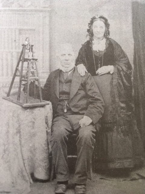
John King with his wife in 1879. (From the book, The life story of John King & The mine cage safety detaching hook invention)
John King in the 1860′s invented the mine cage safety detaching hook. Still manufactured today and is fitted to the majority of winding ropes of deep mines of all kinds throughout the world. It has been responsible for saving the lives of countless miners. A blue plague will be erected in the spring. |
The Museum is on Victoria rd, Pinxton, Nottinghamshire.
Open from March to November on Sundays 2pm to 4.30pm. Dedicated to the industrial, social & family history of Pinxton and South Normanton, and particularly John King & his invention of the mines cage safety detaching hook. The museum keeps records of any historic event, news papers, old photos and mining memorabilia. The museum are always looking for new items and anything you might think of as rubbish or scrap could be a great find for the museum . Chairman: D Deneley, Secretary: N Taylor 01773-810122, Treasurer: S Sterland. Coming Events
|
World War One – Roll of Honour
Your browser does not support viewing this document. Click here to download the document.
Pinxton Castle - Wynns Castle
|
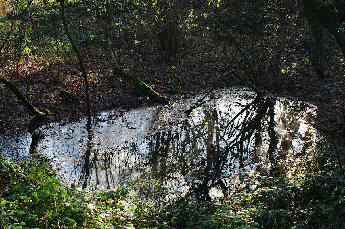
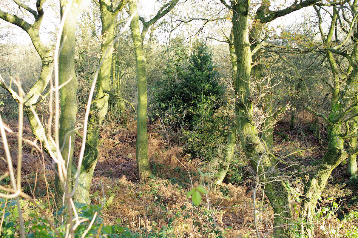
Medieval moat with probable fishponds, visible as earthworks. The earthworks comprise a sub-rectangular moat with a ditch averaging 11m wide and 2m deep.
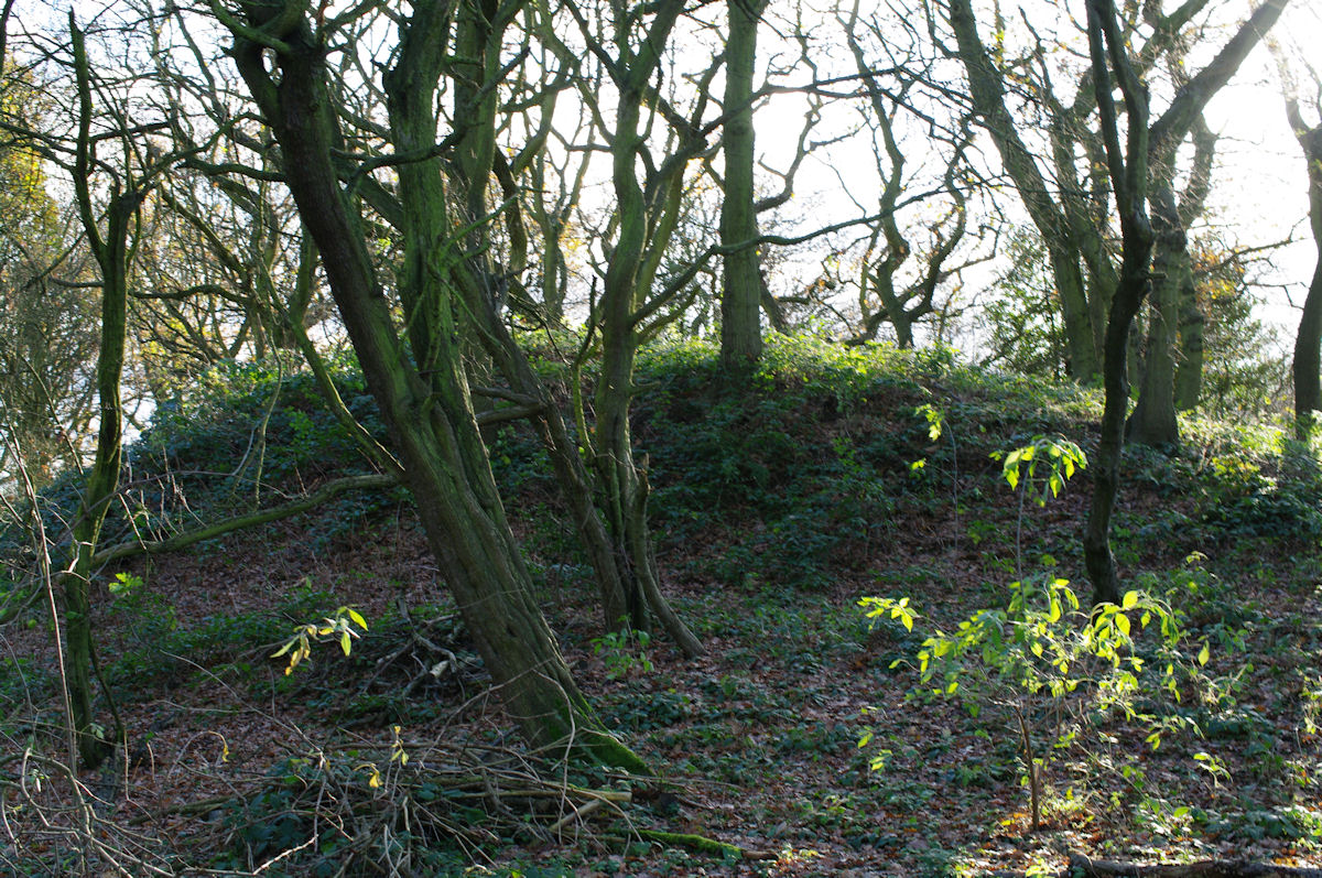
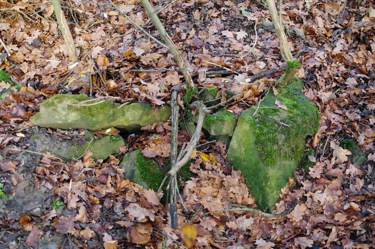
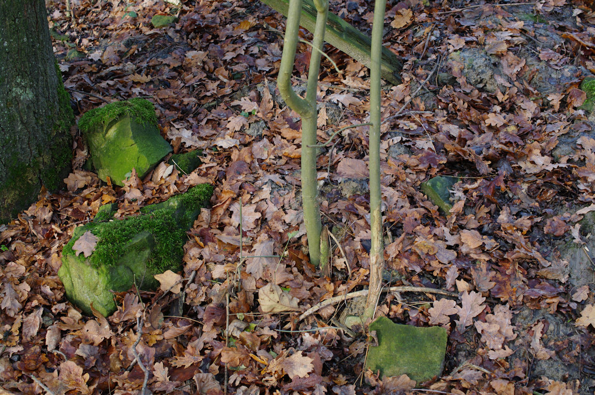
At the western corner the depth is greater due to the southern slope in which it is dug. To the west of the moat is a supplementary bank, 5m wide and 1m high and a further ditch is present on the southern boundary of the wood, 6m wide and 1m deep. The motte is an irregular oval and conical mound averaging 20m in width and 3m high. There is no evidence for a ditch. Excavations in the 1950’s discovered a timber framed building in the inner bailey. The earthworks have been identified as a possible motte and bailey, but the evidence for this, both from the earthworks and excavated evidence, is very weak. It is best regarded as a homestead moat on the available evidence. (PastScape) Pinxton Castle motte is reasonably well preserved and sufficiently intact for archaeological remains relating to the structures on the motte to be preserved and its relationship with the later medieval fortified manor to be determined. Fortified manors were the residences of the lesser nobility and richer burgesses and date from the late 12th century and throughout the rest of the Middle Ages. Generally they comprise a hall and residential wing, domestic ranges, and fortifications such as a moat or crenellated wall or both. The site at Pinxton is fairly unusual in that the moat is located inside a larger fortified enclosure. In addition to the tower and perimeter wall, extensive building remains will survive as buried features throughout the monument. The monument known as Pinxton Castle, or sometimes Wynn Castle, includes the motte of a 12th century earthwork castle and a later medieval fortified manor. Remains include a moated site and five fishponds along with a range of perimeter earthworks. The motte comprises a 3m high conical mound whose level summit has a diameter of c.20m and would have been the site of a shell keep, a type of early castle keep in which timber buildings were arranged around the inside of a circular palisade or wall. In addition to the motte, there would originally have been a bailey or outer enclosure in which further domestic and service buildings would have existed together with corrals for stock and horses. It is possible that the bank extending along the north-west side of the later fortified manor originated as a bailey rampart. The motte is believed to have been associated with Roger de Wynn who held the manor of Pinxton from 1120. The motte is situated at the north-west corner of the fortified manor site and appears to have been reused in the later medieval period as part of the perimeter defences. This is inferred from the existence of a level, 10m square platform at the base of the motte to the north. This platform was the site of a building, possibly a gatehouse. The perimeter bank extends north-eastwards from the platform and measures c.2m high by 6m wide at the base. Together with the banks along the north-east and south-east edges of the enclosure, which are of similar dimensions, it would, in the later Middle Ages and after, have been the site of a wall. Most likely, this wall was crenellated. This would explain why the site continued to be called a castle. Along the inside of the north-west bank there is a 10m wide berm or terrace. Parallel with this, a pair of rectangular fishponds extend from north-west to south-east and are connected by a sluice. Both ponds are c.1.5m deep and 7m wide, but the one nearest the motte measures 13.5m long while the other is c.15m long. They are set 5m apart and the sluice, formerly the site of wooden gates used to control the flow of water and fish between the two ponds, is 2m wide and 1m deep. At its north end, the larger fishpond is connected via a 5m wide channel to a third rectangular fishpond which extends south-eastwards from the north corner of the site. This channel is currently partially filled-in by a rubble causeway which is assumed to be relatively modern although it may be on the site of an original bridging point. This is indicated by a break in the outer bank and the existence of a flat-topped sub-rectangular mound overlooking the causeway to the north. The mound measures 12m by 6m and stands c.1.5m high. It is interpreted as the site of a tower incorporated into the perimeter wall of the manor. The third fishpond is c.2m deep and measures 40m long by 15m wide. To the south-west is a level area which would have been the site of buildings and other features associated with the manor. Also, 10m to the south-east, there is a fourth fishpond which is now largely filled-in and measures 30m long by 15m wide. To the south-east of this, in the east corner of the monument, is a level area measuring c.25m square which would have been the site of further buildings and structures. Along the south-east edge of the site, a fifth fishpond extends for 40m at 7m wide then opens out, at the south corner of the site, to form a pool measuring c.10m square. There is no outer bank along the south-east edge of the monument, though a raised feature indicates that the wall continued at least part of the way along this side. The pond along this side remains waterfilled and is connected to the south corner of the moat by a 2m wide sluice. This indicates that the moat itself probably also served as a fishpond. The moated site comprises a 1.5m high platform, measuring c.30m by 40m, surrounded by an 8m wide partially waterfilled moat which is up to 2.5m deep on the north-west and north-east sides, 2m deep on the south-west side and 1m deep on the south-east side. This variation is caused by the moat having been dug into a south-facing slope. Partial excavations were carried out on the platform in the 1950s by the Pinxton Archaeological Society. Unfortunately, the records of this work have been lost but it is assumed that the society was responsible for uncovering the overgrown building remains which are currently visible and include the level floors of rooms or small structures, wall footings and trenches, sandstone rubble and pieces of brick and roof tile. These remains appear to be of a post-medieval building and overlie the buried evidence of the earlier timber buildings which would originally have occupied the site. |
(Scheduling Report) ‘In Castle Wood, near Range Farm, about a mile to the east of South Normanton, is a rectangular moated enclosure having a square of about 225 feet from the outer side of the trench.
In the centre is a small raised mound, and there is a larger mound close to it on the north-west. It seems to have been some form of an early defensive work, altered in mediaeval days… It is termed ‘Moat’ on the Ordnance Survey map, but it is certainly not to be included under Homestead Moats’ (VCH). The earthwork in Castle Wood, shown as ‘Moat’ by the OS, is known locally as Pinxton Castle, and is a motte and bailey. The earthwork is on a slope which rises about 50 ft. in about 250 yards. to the north and falls away 150 ft. in 1 1/2 miles to the south. The bailey was defended by a wet ditch. The ground of the platform is much disturbed, ‘and what might easily be viewed as a mound and a cross ditch-developing a first and a second bailey may be traced’. The motte is a cone of earth thrown up from the spoil of the north-west ditch, on the most vulnerable side. It was never perfected (Stevenson). Excavations were carried out in 1950 and 1951 on the earthwork known as Pinxton Castle. In 1950, a trench running roughly 30m west of north was dug on the westerly side of the inner bailey. A wall of bonded stone with no trace of cement was found. A corner stone at the north end was located and the excavations proceeded at right angles until conditions stopped operations. Post holes at intervals along the wall suggest a timber-framed building. In 1951, the trenches were located to find the eastern wall. The wall was not so well defined here but the evidence tends to show the building was approx. 30 ft. x 23. ft. An abundance of roofing stone, glazed and unglazed tiles, and pottery fragments were found, all late 14th C. A stone platform, 7 1/2 ft x 5 ft. was uncovered on the north-east corner of the inner bailey. Roofing tiles and pottery was found here, together with a sandstone capital of estimated 1150 date. The site is tree covered and roots made it impossible to fix strata levels. Further excavation is necessary before a clear picture of the original layout can be obtained. The excavations were carried out by the Pinxton Arch. Society (Monk). The excavations by the Pinxton Arch. Soc. were conducted from 1951-4. They were not of a scientific nature and comprised sporadic digging to find walling which was then followed. The plans made, photographs and sketches have been mislaid or lost. The small ‘building’ found, (sited on OS 25″ by auths at SK 45975683) was excavated by following the outer face of the walling. A circular cavity in the walling was construed as a post-hole. The ‘platform’ (identified on the plan at SK 45945685) was excavated among trees with great difficulty. A few potsherds were identified as 14thC. by Sir Mortimer Wheeler during a casual visit to the area. The capital was identified as C.1150 by a member of the Society. Members have a collection of pot-sherds and architectural fragments including the capital, glazed tiles and ornamental ridge and hip tiles. There is little local tradition relevant to the site. ‘Pinxton Castle’ is not used but it is sometimes called Wynn’s Castle’. The association of the Md. Wynn family with the area is confirmed by a few documentary references. There are no known documentary references to the site as such nor is it mentioned as a castle. I am of the opinion that the site was the residence of a local officer of Sherwood Forest as it is strategically placed at the edge of the forest (F1 WW 27-JUL-59). The earthworks in Castle Wood comprise a sub-rectangular moat with a ditch averaging 11m wide and 2m deep. At the western corner the depth is greater due to the southern slope in which it is dug. To the west of the moat is a supplementary bank, c 5m wide and 1 m high and along the south boundary of the wood a ditch, 6 m wide and 1 m deep with a mound-like bank accompanying it on the outside of the wood. In the northern part of the wood a spring rises and was channelled through a former sluice into a large dug depression, probably a fish-pond. Colliery tips are encroaching upon the pond; it may have continued to the south-east to join the southern ditch and so form an L-shaped supplement to the moat’s defences but no certain evidence survives. An oval mound by the eastern side of the pond is probably derived from it. No evidence of an earthen motte and bailey was seen and the suggestion appears to have derived from the Castle element in the place-name and from the mound, at SK 45915687 suggesting a motte. This is an irregular oval and conical, mound, averaging 20m in width and c 3m high. There is no evidence of a ditch. It lacks the flat top of a motte and, in the opinion of this investigator, is probably derived from the adjacent deep ditch of the moat. Within the moated area the excavations by the Pinxton Arch. Soc. have been left open. Fragments of walling of thin, mortared stone can be seen at the southernmost site and building debris, including tiles, at both sides. It is doubtful whether the nature of these excavations justifies the conclusions given by Monk. In the opinion of this investigator the site is that of a homestead moat with associated earthworks Many thanks to Andrew Herrett for the pictures and information by Castle Facts. |

